Category Archives: Adventures

Grand Cayman Island Into The Abyss, Capt. Dive Log

Scuba Diving Grand Cayman

When Jamaica chose independence in 1962, the Cayman Islands elected to stay under British Rule. One thing you will notice flying in, they have ridiculously disproportionate banks to the size of the Island and population. The story goes..

‘…According to the legend, a member of the passenger list for the 10 vessels included a royal prince, one of the sons of Britain’s King George III. The legend further states that when the King was apprised of the bravery on the part of the Caymanians in saving the crews and passengers of the foundering ships, he decided to repay their bravery. The reward became a decree that the people of the Cayman Islands would thereafter be free from war conscription and taxes…’ –wikipedia

And for some reason today people hide their money here. Maybe because they evade taxes? Who knows. but you would think with towering banks, there would be a lot of hustle and bustle, traffic and such. Nope. It’s just a tropical island with big banks. In fact, not far away from main street on a inner city road, I poked my nose in an old, what seamed to be abandoned, shack with no one around. When I looked inside there was a gigantic cow hanging up side down getting it’s blood drained before butchering. Quite the eerie feeling being alone and rolling up on that. A few blocks up the street was a street vender with a bar-b-cue pit cooking up some jerk chicken. (You should try it, it’s yummy). 

“Jerk chicken is a spicy grilled-meat dish that is coated in spices and slow-cooked over a fire or grill traditionally composed of green pimento wood positioned over burning coals; the smoke is the key to the flavor of the dish. Most associated with Jamaica but common throughout the Caribbean.  A mixture of herbs, scotch bonnet peppers, spices, and seasonings that are used to flavor meats that will be grilled. A blend originated in Jamaica, includes ground chiles, black pepper, onions, garlic, thyme, cinnamon, allspice, and ginger.”

Link to Food and Wine Jerk chicken Recipe

My excitement was this was the first time out of the Country where I had to get a pass port and do all that. I did go to Mexico, but I didn’t need a passport to get to Tijuana. That’s a whole nother story! Anyway, I not only got my pass port but I did get re-certified to scuba dive. I have all the gear, not including the tanks. We were going to a World class diving spot. I was excited to having some travel under my belt to start my blogging about travel. Anyway, We landed and stayed on Grand Cayman Island. We stayed at a first class Hotel / Condo. The Grand Cayman Resort. My 1st time at that too.

Other great Scuba diving sites here include Leslie’s Curl, Eagle Ray Pass and … You will likely catch a glimpse of eagle rays, turtles and sharks cruising off the wall. … as well where you can try the local brew, appropriately named. By the way I pet a shark while diving, I believe a Nurse shark -Ginglymostoma cirratum) the local fed it so it was almost like a pet. His shark who’s skin felt like it had 1000’s of tiny plastic bubbles. 

Stingray Beer. [Cayman Island Brewery]

My Dive log: 

00-1 Burlingame Tank Size;
Dive Buddy: Kandie

00-2
9/17/2000
Christy’s Pool – Castro Valley, CA
Location:
Max Depth 6 Max Bottom Time 6 Min.
ME: Tank Size: 80 PSI Start: 3000 Return: 500
Dive Buddy: Tank Size: 80 PSI Start: 3000 Return: 10

Pool PHOTO
I dove with Kandi and her nieces (Sarah & Rachel) to test my equipment. They all got a chance to breath under water. I tested my dive equipment, my new dive watch and dive camera. The dive watch wasn’t working and had to return it as a recall. I had a problem with the Oceanic regulator. It was new, but used. The diaphragm would tend to flip over and I would suck in water; (Many dives later, I found out it was only that the ‘O’ ring was not in!! A very, very critical piece that held the diaphragm in place.) Dooley noted!  This is why I test and retest!! AND RESEST! 

Day 2
9/18/2000
I tired the new dive watch (Aeris / Savant dive computer) it working fine and logged ”6 ft 6 minutes of testing equipment.’ But reset too? It’s difficult for me to grasp. Only two buttons that do a lot. The kids adored diving. My framing was way off with the camera. I’m using the Sea & Sea USA – Underwater 35 mm Photography Camera

 Grand Cayman Island
Grand Cayman Island

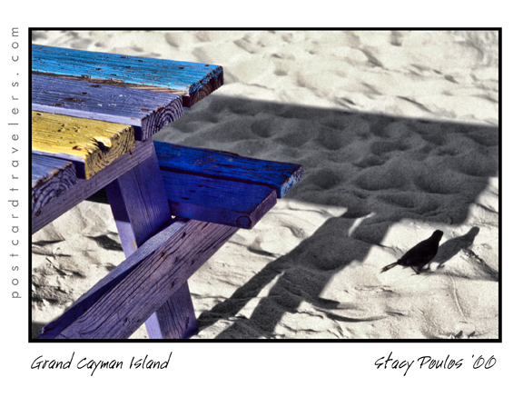
Grand Cayman Island “Public Beach” Grand Cayman Island “Seven Mile Beach”
9/24/2000
Total Bottom Time: Snorkle Max Depth 15 ft.
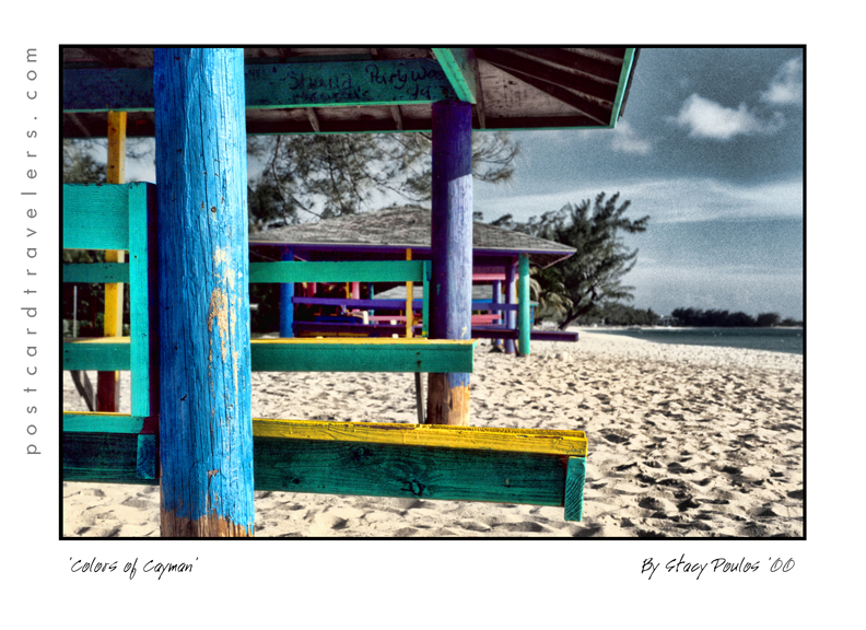
This is a great photo opportunity for sandy beaches. The cabanas are painted mint green, pink, blue, purple, etc. Very tropical and cute. The beach is white sand with a shallow depth of about 15 feet deep. The Hotel had us a bbq party with the rest of the Hotel “Spicy Jerk Chicken”, a island specialty. The Popular beer here, or as they say, the Caribbean is “Red Strip” it’s a doable beer. Not to fancy attack on the taste buds. I say it tastes between a Bud and Amstell light.

We just snorkeled, not to many fish. Small ones huddled around underwater gadgets like a cement block anchor. Kandie seen a 2 foot spotted sing ray. As Kandie will attest to why you don’t handle the animals. She tired to pose for a photo, and it whipped around and stung her, about a 1/8 of a inch cut on her left hand. I can’t personally tell you what it feels like but she only got a small warning that hurt for about a half hour.

We fallowed around a pipe line and the fish seamed to hover around it for shelter. I took photos with my 35mm Sea Reef ASA 400 film. There was plenty of light due to the shallow depth and sunlight.

 Grand Cayman Island
Grand Cayman Island

Later “Pepe” our Hotel driver — who I might add, took a liking to me and made sure I had a personal tour guide. Of course Kandie doesn’t like to be social at all, and gets annoyed at me. Not anymore than I get at her for being unsocial.

So anyway, Pepe drove me back to the beach to get my sandals I left behind. He insisted he take me to different spots to see the sun set for photo opps. He knew I was a professional photographer. I got a photo of a miniature lizard. A fisherman in a green boat, and back at the public beach I took sunset photos of the cabanas.

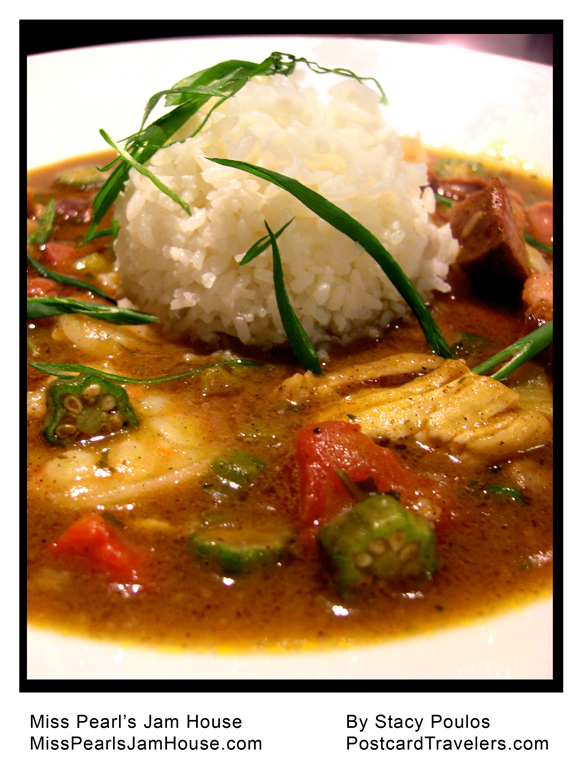
I got some photos of the Hotel and Peake, the cook holding a beautiful plate. In most cases I used a sky filter on the camera. (35 mm Minolta)

I met Gaylyn at the pool I asked her to be a stand in for a photo. We became friends. Eventually I passed out from exhaustion at the end of the day.

9-25-2000
The Hotel offered to go on a day Cruz of Crystal Harbor. Where we met officially Gaylen and her girlfriend Tree who soon became our travel friends.

I picked up the photos I sent in for development.

Dive Log 00-3
9/28/2000
Time: 1:11 US/Sf time
Total Bottom Time: 26 min. Max Depth 45 ft.
LOCATION: Grand Cayman Island “Eden Rock” Church & Grand
Eden Rock North W.50 19’17.618 N 81’23.227W 20 1
Eden Rock South W.51 19’17.586 N 81’23.236W 20 1

Diving with Cayman Diver Ltd.
Capt. Don Foster. WEB  / Facebook

00-140

LOCATION:


View Larger Map

Scuba Diving Grand Cayman

9/28/2000
Time: 1:11 US/Sf time
Total Bottom Time: 29 min. Max Depth 105 ft.

00-4 Leslies Curl
LOCATION: North Side Grand Cayman Island
Leslie’s Curl N.18 / Latitude 19’23.030 N Longitude 81’19.214 W Depth 60 PIN 1

Grand Cayman Island “The Wall
currency in Grand Cayman is the Cayman Island dollar (CI$) which has a fixed … and
Time 16:43 (US/SF Time?)
Total Bottom Time: 29 Max Depth 105 ft.

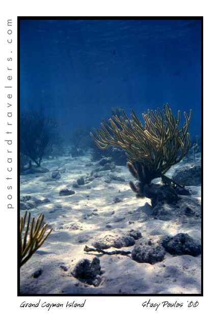
Swim with fishes 24 hours have gone by sense I swam to the edge of the abyss known as “The Wall” on Cayman Island. I was at 105 feet looking down into deeper darkness, venerable to another planet on earth. Amazed at it’s Grandeur and beauty, fearful of the unknown. Yet brave enough to swim to the edge. Every move I made, I was conscious of the oxygen I was breathing in, conscious of every shallow breath, as the sounds of my bubbles so deep in the ocean ascend as I slowly descend. I am more amazed to look up, where others are amazed to look down and around. Here I am; living and breathing deep underwater like a fish. Sunlight at the surface trickles beams of light through the water as though you can reach up and grab one over 100 feet away. Looking at the bottom of our boat. Wow! Wow, at it’s beautiful, and Wow, that I am breathing where few dare to tread. And wow, I can die. As I try to relax and take it all in, I try to focus on something besides the apparent sound of my troubled breathing. Our guide pointed out a giant ‘Spotted Stingray’ gracefully gliding through the water.

I caught up with him and fallowed behind the Ray who swam more graceful than anything I had ever seen. His wing span larger than my arms. As I got closer he sped up, >>>>>>>just a little more faster to my advance, and looped shortly into a sore down the edge of the abyss, until I was at my maximum depth 105 feet then back up. I fallowed him, mimicking the movements of his wings, then back up 98 feet floating into a soft ascend. For a moment I felt the sensation of what a bird following a flock of birds. Wondering what it would be like to be him. As I got closer he would speed up, being more cautious of my moves. For a moment I forgot about my breathing and all the fears I had, I was one with his grace.

Sting Ray City, Grand Cayman Island


My Map Cayman Islands Dive Guide Franko Maps Waterproof Map Map – October 1, 2018 https://amzn.to/40r54kh

Fodor’s InFocus Cayman Islands (Full-color Travel Guide) Paperback – June 29, 2021 https://amzn.to/3jnjSjg
Kendal https://amzn.to/3XZWveV

Cayman Islands Reef Creatures Guide Franko Maps Laminated Fish Card 4″x6″ Map – June 1, 2010 https://amzn.to/3RmP7aZ

Fodor’s InFocus Cayman Islands (Full-color Travel Guide) 2021 https://amzn.to/3Hqtyl1

Reef Smart Guides Grand Cayman: (Best Diving Spots) Paperback – Illustrated, October 27, 2020 https://amzn.to/3YbI1Ig
Kindle https://amzn.to/3wRClHX

Cayman Islands & Jamaica 1:37,500/250,000 road Map – Folded Map, July 10, 2012 https://amzn.to/3X2SBjQ

Buy Direct from Frankomaps… http://frankosmaps.com/cayman-islands

► ► LinkTree: https://linktr.ee/postcardtravelers

► Blog: https://blog.PostcardTravelers.com

► Instagram:  https://Instagram.com/postcardtravelers

► Video Channel:  https://youtube.com/PostcardTravelers

► TikTok https://www.tiktok.com/@postcardtravelers

► Twitter:  https://twitter.com/PCTravelers

► Need a product or service reviewed? Send it to:

PostcardTravelers PO Box 20608, Castro Valley, CA 94546

Have camera, will travel.

Established in 1984 aka Playback.net Video Film Multimedia

🎥 👻Spud Island Shipwreck Delta CA 🇺🇸| By Stacy Poulos PostcardTravelers


After 2 years of planning and a 2nd attempt to find it on the Delta, I finally found my Shipwreck! For now it’s the ‘Spud Island Shipwreck’ since there are no markings and I can’t find any information on it. It will officially be the ‘Spud Island Shipwreck’. On the way to the wreck #CaptainBonnie (Bonnie Nasworthy Jones) pointed out a sunken city. I call ‘Jones Track Ghost Town’, an abandoned sunken Ghost Town. It consists of a few floating (or not floating) buildings and house boats abandoned by a man who left them behind to live in Costa Rica. Now the Delta  is slowly swallowing them up. It’s definitely a ominous Ghostly scene. I took many photos of both locations. I didn’t get to spend as much time flying over them for my battery only lasted 10 minutes.  rrr. Anyway, what a journey! Thank you Captin Bonnie for being such a brave, patient and great caption to get me there and back safely through the twisted and dangerous areas of the Delta and San Joaquin River! Stand by for the video ‘Journey to Spud Island Shipwreck’ and keep and eye out for my photography from the trip. www.PostcardTravelers.com by Stacy Poulos & Eye Fly Cinematography
Sponsor REI goo.gl/thWgwA
 

Winter is coming…  

 
This video on Youtube: https://youtu.be/InY-7H_q1z0
 
_________
 
#abandon #JonesTrackGhostTown #GhostTown #Ghost  #deltaca #Deltacalifornia #sanjoaquinriver #boating #bayareaadventures #stacypoulos #postcardtravelers


______________________________

Postcard Travelers | Adventure Life Magazine

Host: Stacy Poulos  Adventure Live Travel Reporter / Filmmaker / Shipwreck Hunter

Author of: Life In A Nutshell

► ► LinkTree: https://linktr.ee/postcardtravelers

► ► Favorite Things

https://postcardtravelers.com/favoritethings

► Blog: https://blog.PostcardTravelers.com

► Facebook:  https://www.facebook.com/postcardtravelers

► Instagram:  https://Instagram.com/postcardtravelers

► Pinterest Bucket List:  https://pinterest.com/PCTravelers

► Video Channel:  https://youtube.com/PostcardTravelers

► TikTok https://www.tiktok.com/@postcardtravelers-com

► Twitter:  https://twitter.com/PCTravelers

► Linkedin:  https://www.linkedin.com/in/stacy-poulos-89194013/

► Need a product or service reviewed? Send it to:

PostcardTravelers PO Box 20608, Castro Valley, CA 94546

Have camera, will travel. Ask about my Drone and 360 services.

Established in 1984 aka Playback.net Video Film Multimedia

©2019 Postcard Travelers

King Tides equal shipwrecks and treasure hunting!

Pirates, shipwrecks, and Ghosts Adventure Map By Stacy Poulos PostcardTravelers.com

There is nothing like a full moon to uncover what lies beneath the surface of the earth. I’m not going to lie, I’ve been learning as I go about this phenomenon called ‘tides’ since I have been kayaking and was basically stuck in the mud trying to get to the shore walking my boat in mud up to my knees. It’s something I knew about but never really understood it’s wonder.  And then there’s King tides. Which is an even greater water level. Which I took notice when I was kayaking in Alameda and couldn’t get close to my kayak partner because the current was so great and I was tired from a long day of kayaking. So it’s not advisable to be kayaking or boating, or even being near the edge of the water because of sneaker waves. But at low tied it’s a great time to see what has been under the water all this time. During this King tide the water level reached 7+ feet at highest tide in the SF Bay Area. For me this mean there are a few ships including one from the 1800’s I have to go see at it’s lowest tide. This King tide will last just a few days.

Unfortunately the lowest tide had been at sunset, and with the clouds almost impossible to see, but I DID!  I was at Point San Pablo at 5pm ish and on the road looking into Point San Pablo Harbor and off to the left of the harbor you can see the shape of what appears to be a large wood ship. What is left is just the frame that look like a fence of just posts.

King Tides Week of January 21-23

Here are some important tips that will educate even just a hiker or walker along any Bay or shore in the world! No matter where you go. And if you are traveling, you are most likely planning on being near water! So be aware, knowledge is power.

Parking. With out looking at a tide chart, you can logically look at the ground and see where the water line is on low and high tide. Usually the water line is pretty apparent.  Know that if it is low tide and your car is far away from the water. It can possible be submerged when you get back! Or the road you came in will be submerged as well. Almost for sure when there is a King tide.

Kayaking and boating and being stuck in the mud. Have no fear. Know that every 6 hours the Tide changes direction. Before it dose it will sit for a hour before it makes it way back called a slack tide. Most the time you don’t know the tide is even moving. So it can creep up on you. Lets say you planned to get out of the water and there is 20 feet of mud. You can wait it out cut it will eventually fill up.


Wikipedia Ebb and Flow
“Ebb and flow (also called ebb and flood and flood drain) are two phases of the tide or any similar movement of water. The ebb is the outgoing phase, when the tide drains away from the shore; and the flow is the incoming phase when water rises again. The terms are also common in figurative use…” – Wikipedia

Slack tides

“Slack water, also known as ‘the stand of the tide’, is a short period in a body of tidal water when the water is completely unstressed, and there is no movement either way in the tidal stream, and which occurs before the direction of the tidal stream reverses…” – Wikipedia

More incite: When you see a boat in the mud tipped over, have no fear. It’s most likely the owner misjudged the tides and soon the water will be back to fill up.

Boater rules. It is boaters curtsy and I think law that you’re never supposed to pass by a boater in need of help. [article] You could save their life, even if at the moment they seam to be fine.

Currents. Currents are whats happening underneath. When you get near large objects like bridges, boulders, etc. The water rushes more and is stronger to get around those objects.  Think of the SF Bay as a big bottle of water with a  small neck (the golden Gate Bridge) that poor into another bottle of water and it takes 6 hours to pour on to the other bottle. As it pours back into the SF Bay it fills all the little bays as it goes back out to sea it’s sucks the water from the shore line leaving sometimes 4 to 20 feet of mud depending where you are at. This is world wide. If you don’t want to be stuck in the mud, plan on coming out of the water at high tide. However, you also want to think about the direction of the current. It’s a delicate balance of knowing the current. Sometimes, excuse my language but it can be a bitch going against the current! So there are 2 known factors tides and current. The wild card is weather / wind factor. You can go with a current but against the wind. And honestly I don’t know what is worse. And then there is light. Ya, you got it planned out on paper, but what about sunset? Will you be able to see when you get out? And if it’s cloudy or near mountains or cliffs you can loose hours of good light!  Whew, thats a lot to think about. But you should always think about it!! One time when I was in Zion National Park we didn’t start a hike until 3pm, I know, duh!! Not my fault. Anyway, even though we could see at the top of the mountain. Walking back it was in the straight up dark! The mountains basically had us in a crack in the ground. Luckily I was prepared and had a head lamp light in my arsenal of stuff. Petzel is a great bran. Always buy your adventure gear at REI, I recommend becoming a member worth the bucks. You’ll get it back in lots of lifetime savings!  They are our sponsor and affiliate because I love them!

Headlamps
Petzl Headlamps


A cheaper and great option is this little head lamp that I clip on my hat. Best thing since sliced bread! I love it. I have two one for me and on for a adventure partner. They are usually never prepared. I always wear a baseball cap. If you don’t, it’s not the best option. For me, it is!

My Favorite Amphipod Swift-Clip Cap Light


I also have one of these clipped on my belt hiking belt. And life jacket. I think it’s great to have at all times. Not exactly a flash ligt but in a emergency it can help guide you hime. However I don’t know how water proof it is. Just don’t be cheap about these items!


Favorite thins Nite Ize SpotLit LED Carabiner Light


Maps or better yet officially called “Charts” A NOAA chart will show you how deep the water is at it normal low level. It will also show ship wrecks the are submerged so boaters with engines don’t run into them.  For me it’s a place to explore and how I found may locations of shipwrecks. They are free on line. If your a boater / kayaker I recommend buying the one of the area you frequent. For me it’s like a treasure map!

[LINK to Charts]

I will up date this blog as I find my shipwrecks during the King Tides.

May Adventure Map. Zoom into Ocean Beach Area, Hunters point and Richmond bridge area on the Richmond side and Point San Pablo. There are layers at the top you can turn on more layers and turn off layers.


Have a great adventure, be safe by being wise.


Put this on your busket list:
Nobilis Restaurant
1900 Stenmark Dr
Richmond, CA 94801
Phone number (510) 233-3224

By Stacy Poulos Postcard Travelers

Postcard Travelers Adventure Magazine
Host: Photographer / Filmmaker Stacy Poulos

Author of Life In A Nutshell

**Blog: http://PostcardTravelers.com
**Fan: http://Facebook.com/postcardtravelersxoxo
**Instagram: http://Instagram.com/postcardtravelers
**Pinterest Bucket List: http://pinterest.com/PCTravelers
**Video Channel: http://youtube.com/user/PostcardTravelers
**Twitter: https://twitter.com/PCTravelers

Need a product or service reviewed? Send it to:

PostcardTravelers
Po Box 20608, Castro Valley, CA 94546

Have camera will travel.
©2017 Postcard Travelers
Sponsor REI goo.gl/thWgwA

Travel And Adventure Show A World Inside 1 Room by PostcardTravelers

They’re Back!

Travel And Adventure Show 2022 dates

 [PostcardTravelers]
Rick Steves' Greece: Athens and the Peloponnese

My favorite time of year again! The Most Exciting Travel Show Returns to the Bay Area and I will be there to get the scoop. Tickets are available on line or at the door. My mentor Rick Steve’s will be there to name a few. The interesting thing about going to expo events like these, is how excited you get when you’re surrounded by things you love. Who doesn’t love to travel?  This show is at the Santa Clara Convention Center but there all over the USA. Click on the book!  

SF / Bay Area: May 21-22, 2022 + Other locations and dates. 

Event Description; The Bay Area Travel & Adventure Show is where travel lovers come for travel inspiration, expert information and fun, cultural interaction. It’s where you’ll discover thousands of authentic travel experiences and speak directly to the travel experts who can get you there, give you the inside scoop, and save you money on exclusive travel deals.

Host, Rick Steves’ Europe, Samantha Brown, Travel Channel Host, and Pauline Frommer, Editorial Director of the Frommer’s Guides and Publisher.  

Or Pauline Formmer’s guides

Link to event http://travelshows.com

Stacy Poulos PostcardTravelers.com Adventure Magazine

Hot tip; I get

ON SALE!!! Shop REI Gregory back pack

My gear at REI. I love everything about them. Most recently I bought this backpack that is light weight and has a frame on the inside. Seriously I love it!

Tip: One Month to Live Author Patricia Schultz gives us 5 places to go. 


Sample booth:

Get the calendars:

Bay Area Water Front
 https://www.cafepress.com/postcardtravelers.1494374887 

Haiti
http://www.cafepress.com/postcardtravelers/12070849


#Travel #bayarea #postcardtravelers  #Adventure #2019 #calendars

______________________________ 

Postcard Travelers | Adventure Life Magazine 

Host: Photographer / Filmmaker Stacy Poulos 

Author of: Life In A Nutshell

► ► LinkTree: https://linktr.ee/postcardtravelers 

► ► Favorite Things https://postcardtravelers.com/favoritethings  

► Blog: https://blog.PostcardTravelers.com 

► Facebook: https://www.facebook.com/postcardtravelersxoxo 

► Instagram: https://Instagram.com/postcardtravelers

► Pinterest Bucket List: https://pinterest.com/PCTravelers 

► Video Channel: https://youtube.com/PostcardTravelers 

► TikTok https://www.tiktok.com/@postcardtravelers 

► Twitter: https://twitter.com/PCTravelers

► Linkedin: https://www.linkedin.com/in/stacy-poulos-89194013/

► Need a product or service reviewed? Send it to:

PostcardTravelers PO Box 20608, Castro Valley, CA 94546 

Have camera, will travel. 

Established in 1984 aka Playback.net Video Film Multimedia

©2022 Postcard Travelers 

©2018 Postcard Travelers

Women's Black Heart Black Leather
Women’s Black Heart Black Leather

Save

Kaboom! Holy Moly I Was Almost On Fire, Best Kayaking 4th of July in Aquatic Park SF By Stacy Poulos PostcardTravelers

kayak path 4th of July aquatic park sf Postcard Travelers

See the video below for my tour of the day.

NOAA Chart 18649
NOAA Tides

Willy Weather  

Kaboom! I can take this off my bucket list, being directly under the projection of the fireworks at the Aquatic Park Historic District pier!  We put-in our boat and launched at Hyde Street Pier in San Francisco, California. Hovering  under the pier A little too close for comfort, until the fireworks unsuspectedly started. The current kept making us drift quickly away so we hovered under the pier. We even had all our lights off to save batteries, so we were in the dark. The first echoing Kaboom explosions under the pier were un-describable. Enough to rattle your nerves! I was deeper under the pier being in the back of the boat looking out at Ghirardelli Square. *In this video I said ‘last time I got in trouble’. It was because I got too close to the  Historic boats. There were no signs that I could see at the time. It is kind of roped off with buoys. This time we stayed further away out side the line. One way or another, I recommend this spot. During the day there is a live concert  on shore. We had a back stage pass, a nice little additive to the day. The yellow box with the star is where the fireworks barge is. The Teal Green boater is where we hovered until the fireworks started. 

fireworks projection san francisco Aquatic Park

However, I don’t recommend right there. Much too close. Instead bring a anchor at least 20 feet long and hover at a safe distance like we are in the photo below. To the left and center of the park here we are look at the Municipal Pier a posed to being under it!

fireworksaquaticpark


Live Concert at Ghirardelli Square 4th of July


So, planning for next year. I recommend going here. Be more prepared. I do own a kayak anchor. When I looked at the Coast Guard Map it said it was around 7-14 feet deep in the area but there is only one marker and I didn’t think my anchor was that long. Besides it being a pain to add more weight. Next time I will bring one for sure! If your planning on hovering in the ocean, there is always a current. Anyway, below is a live interactive google map with all my notes for 4th of July over the years in the SF Bay. If you click on any icon, it will zoom into that note.  When you click on  ‘Aquatic Park Historic District‘ And look at the orange line that was our path in 2017. To the upper left of the map are my notes, that little box’ie icon on the upper top left corner opens the notes, click on anything at it will bring you to the spot on the map. Bottom right is the + and – zoom button. You can then close the notes with the left arrow it to get the notes out of the way. I also have a layer of land notes, where I intend to go for a city hike and check out the same area on land someday.


Aquatic Park Historic District pier  Ghirardelli Square 4th of July
Aquatic Park Historic District pier Ghirardelli Square 4th of July


Launching on Hyde Street Pier AquaticPark. I’m not sure you can launch out of the museum. Since the public beach was full of people we couldn’t go their.

#SanFrancisco Maritime National Historical Park

Coordinates 37.8063°N 122.424°W

History of the 4th –
I think this is one of the safer and best spots in the San Francisco bay to view the fireworks from land or water. If you know the History of the 4th, or Independence Day and the inspiration to our National Anthem, you would know the 4th of July is meant to replicate what Francis Scott Key seen on that fateful day in 1812. He was a British lawyer on the French Ship; HMS Tonnant negotiating a British prisoner exchange were he was to negotiate the release of prisoners, during the Battle of Baltimore at Fort McHenry. (The only other place that can possibly top this spot). Key learned too much about the French’s attack on the British, so they kept him a prisoner as well. So all during that night Key witnessed the fireworks in the bay of Fort McHenry. In the morning when the fireworks stopped, and lack of communication the only way to know who won the battle was the American flag still standing. He wrote a poem “Defence of Fort M’Henry”, that later became the lyrics to ‘The Star Spangled Banner’.

Photo: Battle of Baltimore 1812 or Aquatic Park SF 2017?

Bombardment of Fort McHenry by the British

History https://en.wikipedia.org/wiki/Battle_of_Baltimore

So why is this the best spot? First of all, the Maritime National Historical Park is situated inside Aquatic Park San Francisco… in the water! There are period ships to set the perfect scenery of what the bay may have looked like. The ships are much younger in the park; like the Balclutha 1886 and the C. A. Thayer 1895 but look very similar. Add a dark sky with a silhouette of the old ships sails from the 1800’s lit up by fireworks, well you’ll get the picture and full effect. A lot of people don’t know this History, so why do I? I wrote a book report in the 4th or 5th grade about it. I found it fascinating that people were so affected and heart felt over a song, it inspired me to want to write music. So now you know. Now let’s let Key set the story and imagine the background.

https://www.nps.gov/safr/learn/historyculture/historic-vessels.htm

Lyrics & Music  [link]

Oh say, can you see, by the dawn’s early light, What so proudly we hailed at the twilight’s last gleaming, Whose broad stripes and bright stars, through the perilous fight, O’er the ramparts we watched, were so gallantly streaming? And the rockets’ red glare, the bombs bursting in air, Gave proof thru the night that our flag was still there. Oh say, does that star-spangled banner yet wave O’er the land of the free and the home of the brave?

SanFrancisco Maritime National Historical Park Below
SanFrancisco Maritime National Historical Park
Fireworks Francis Scott Key, 1779–1843

Lyrics link

Text: Francis Scott Key, 1779–1843

Music: John Stafford Smith, 1750–1836

So we won. And every year we celebrate this day in a grand way.

Reason 2, why it’s the best place to kayak on the 4th? The park is protected by a breakwater pier. However, that doesn’t mean there aren’t strong currents, but it’s a protected area and larger boats can only go 5 mph. There are actually crazy swimmers swimming at night. There are police and coastguards near by. Of course if you don’t have a walkie talkie that wont do you any good. So it is most watched by land and sea.

Next good reason, the fireworks barge is directly on the other side of the pier and they project the firework into the park. Giving the people on land and sea one hell of a show! Wow!! We hovered under the pier until the fireworks started because the current was so strong it kept making us struggle to stay in one spot. On land you can walk and board the ships.

Aquatic Park SF NOAA map chart 18649

http://www.charts.noaa.gov/OnLineViewer/18649.shtml 

The depth in the park looks to be 7 to 14 feet deep. Of course I wouldn’t recommend where I was, the first fireworks rattled me to the core. Being under the pier echoed the effect in such away that you felt you were in a war being bombed. Not sure your supposed to be under there but we needed to be protected by the current. Eventually we let loose and drifted to the center of the park facing the fireworks and current. It was foggy as SF is, but it also had a unique effect in it’s self.

Dolphin Swim & Boat Club and South End Rowing Club

We Put-in at Hyde Street Park. I’m not gonna lie, I’m not sure your supposed to. I heard there was a public beach launch to the left of the photo but it was all blocked for pedestrians to view the show on shore. Since we got out next door to the rowing and dolphin club, I assume they assumed we were with them. Frankly it’s not fair there aren’t more safe put in areas for the public to launch. So you might want to try to arrange something or find out the real rules. We parked our car in the red zone on Hyde street, dropped the boat off onto the side walk, my friend parked the truck while I waited.  We communicated through walkie takies, which I highly recommend getting water proof ones even if you don’t think you need them. You don’t want to kill your phone batteries trying to communicate and it’s a pain other wise. I will list my personal favorite things kayaking. Eventually we walked the kayak through the crowded street.

Live Concert at Ghirardelli Square 4th of July

So, the park is not that big to explore a whole day, and if your going out side the park it should be done in much better conditions. You can putt around the park and see the ships below, just don’t get too close or they get mad. To the right / east, are docks you can explore. You can go in a area all the crab fishermen dock their boats. There is a lot of untold History in them, some barely afloat. Also before you get in the water you can actually go on these Historic ships for a small fee that supports our wonderful parks.

https://www.nps.gov/safr/index.htm

It was next to the Dolphin Swim & Boat Club and South End Rowing Club. You might want get involved with them to launch your kayak. We technically just walked through the Hyde Street gate and put our boat in. However the gate closes at 5pm, so you have to be out by then, or the gate is locked. You can technically still get out from inside, but not go back in, should you leave something behind. It’s a beach launch and even though it’s a protected area, there is a strong current when it comes time. How ever it’s protected and the current isn’t as strong as out side the park. It’s cool because you kayak next to old ships. Perfect setting for 4th of July. We hovered under the pier until it came time for the fire works. But be aware, even at 9pm at night there are crazy swimmers. We had the best seat in the house, with a back stage pass to a concert and being literally under the projection of the fireworks! Here’s a important notation it’s a beach launch, pretty mild. You go through the gates of the Museum and the gates close at 5pm. Most the people who work at the Museum are volunteers over 90, kidding. I don’t think they care.

However you can still get out because the gate is only locked for people getting in. So if your out in the Bay and need a emergency out, here it is. There is a public restroom.

To take a rest, we ended up landing at the Dolphin Swim & Boat Club. The girl sitting on the beach was really nice and helped pull us ashore until she realized we weren’t members cuz we asked dumb questions. Then her face turned unfriendly like we were on her property and said they don’t take to kindly to non-members. So we went next door, and went out the Row Club doors to the street. Much more friendly group of people. They promised they would let us back in to get to our boat.

We just wanted out of the water to rest. We just weren’t sure where to go, so we can come back to our boat. I just think it’s pure BS. 4th of July, land of the ‘free’ BS. Land of we own this, get the f’ off. When it comes to boating it’s dangerous to send boaters back out that need to rest. Or set their lights or get out of rough waters. We had struggled for a long time against the currents and wind, we needed to rest. I’ve got nothin’ for people that don’t help, sorry I disturbed your cozy picnic. I mean we are loaded down to kayak, do we look like we want to stay here? All in, all. There were only 4 kayakers besides us, anyone who really kayaks wouldn’t go out in, apparently, gusting winds which I wish they would say MPH, which is 16.1 to 19.6 MPH. Gusting means ‘gusting’ temporary burst of wind. Ok got it! Ya, so I’m learning as I go. Anyway, take that off my bucket list.

Fisherman's Warf SF Stacy Poulos Photography
Old Fishing Boat Fisherman’s Warf SF Stacy Poulos Photography

Anyway, once parked we went across the street to the fancy Blue Mermaid Restaurant. I looked like a Uni-bomber with my kayak vest still on, walkie talkie, pilot knife. I had coffee while my friend had oysters and beer. Absolutely beautiful restaurant. I must go back. Anyway, all in all it was such a great evening. After the hair raising fireworks, Instead of leaving immediately, we loaded up the car with the boat, parked then went to a bar Jacks Cannery Bar  for a night cap to let all the traffic go away.  Sucks having to drink expensive beer (cash only) out of a plastic cup, when you just risked your life, I don’t know how many times… welcome back to land. But there was a mixed group of out of town’ers fun to chat with.

Below I listed some of my favorite things kayaking.

#1 My Kokatat MsFIT Tour PFD – Women’s  Life vest.
I love the walkie talkie pocket and the front stretch mesh pockets to stow essentials. The pocket are not water proof. But when I do put things in the pockets, they are in plastic in need be. The deep-cut neck and armholes maximize range of motion for my arms, there is a difference! I used to kayak  with a ‘water ski jacket’ and it gave me rub burns under my arms. Your life vest is –your LIFE Vest! It’s a investment. Having things on your body and not hanging from your neck it super important. If you capsize you have less to get hung up on.  Chapsitck and sunscreen and cell phone is in the pocket! However, getting back in the boat you have the pockets to contend with.  Kokatat is a great brand, when I went to The Travel Show, a pro Kayker had one and she gave me a personal tour of her’s and she swore by it. I had my eye on it the first day I seen one. They are all very adjustable in size. I have a Large. You can say I’m smitten by mine.   It also has a ‘Strobe lash tab’ I guess thats what they call it. Anyway, you can attach other things to it, for me I have my Rambo  ‘NRS Pilot Knife’ which I love.  There is Reflective tape on the back and chest. You never know when you will be out at night fall.

I will get more into products I love in a dedicated blog


Kokatat MsFIT Tour PFD – Women’s

Kokatat MsFIT Tour PFD – Men’s

Kokatat MsFIT Tour PFD Women pro favorite
Kokatat MsFIT Tour PFD Women pro favorite My NRS Pilot River Knife (Rambo) knife is always ready for action. It’s 3 inch stainless-steel blade with blunt safety tip has both smooth and serrated cutting edges; matte finish with a are hole in the handle that serves as a valve wrench for an oxygen tank a bottle opener is built into the handle. Comes in handy for many uses.


My NRS Pilot River Knife (Rambo) knife is always ready for action. It’s  3 inch stainless-steel blade with blunt safety tip has both smooth and serrated cutting edges; matte finish with a are hole in the handle that serves as a valve wrench for an oxygen tank a bottle opener is built into the handle. Comes in handy for many uses.


NRS Pilot River Knife

Favorite NRS Pilot River Knife

#2 Walkie talkie!

Motorola MS350R 35-Mile Talkabout Waterproof 2-Way Radio (Pair)
This is one of my favorite products. You think, everyone has a cell phone why not just call? You don’t want to ware out your cell phone communicating out on the road, trail or water. I use them everywhere! Hiking, kayaking. Used them in Europe to talk to my friends. Hands down best buy. They have a charging case so you just place them in the cradle after a long day. My mom got me mine for my birthday. You don’t want to dial and wait to ring, you want to send your message.

Ad a whistle to your vests, (super important) and your good to go! The whistle replaces a horn on a boat. I’ve actually been hit by a big boat, not dead on but swiped the side of my kayak. Having a whistle can help you let them know you are their since we sit so low in the water.

New discovery:  Waterproof Socks Amazon (See my review  https://blog.postcardtravelers.com/?p=633 )

PostcardTraveler Adventure Magazine
Host: Photographer / Filmmaker Stacy Poulos
 
Author of ‘Life In A Nutshell’
 
>>Pinterest Bucket List: https://www.pinterest.com/pctravelers/
 
Need a product or service reviewed?
Send it to: 
PostcardTravelers
Po Box 20608, Castro Valley, CA 94546
Have camera will travel. 
©2017 Postcard Travelers
boat launch  at Hyde Street Pier in San Francisco, California

Point Richmond California Adventures; Shipwrecks to Rosie The Riveter to Boasting The Worlds Largest Winery

By Stacy Poulos PostcardTravelers

Wineheaven

I’m always astonished how much rich History, or HerStory, there is right under our noses in the San Francisco Bay Area. I explored the waterfront area of Richmond by land and sea in search of what was once the largest Winery in the world when the California Wine Association moved from San Francisco to Point Molate Richmond after the San Francisco Earthquake in 1906. It remained the title of “World’s largest winery” for 12 years!! (1907–1919). Until prohibition crushed it’s demise and was shut down in 1919. Really, THE largest?  Over Italy and France? Yep, it’s true. Now it’s an abandoned ghost town once called “Winehaven California” (It is in the U.S. National Register of Historic Places) and it’s castle remains in tact north of the Point Molate Richmond. Stenmark Drive is the last exit before you get on the Richmond Bridge and it is littered with a extraordinary and riveting California History.

#richmondcalifornia #californiahistory #explore #kayak #hike #adventurelife #postcardtravelers #favoritethings #favoriteplaces #bayarea #bayareahistory

REI goo.gl/thWgwA

Great things for any adventure @ REI Co-Op

The largest Wine producer in the world for 12 years.

If you walk on Pt. Molate Park Beach facing the water Winehaven would be to your right, around the corner less than a mile away, you can’t walk to it on the beach, but you can see it. If continue to drive on Stenmark Dr you can see the backside through the fence from the road. There is a bit of a battle to what they are going to do with the area. In my humble opinion, it is rare to be able to boast the ‘largest in the world’ of anything, let alone the most prestigious commodity of wine! So. I say restore the castle and keep boasting! But there’s more.

Winehaven Pont Molante 1907-1919

Winehaven 2036-2040 Stenmark Dr. Near Point Molate Beach Park Richmond, CA

My map and notes.

Shipwreck

App Skipper NOAA Boating map Richmond, CA   PDF Version: 18652 pdf  

Digital NOAA Chart https://devgis.charttools.noaa.gov/pod/

3 Shipwrecks Pt Castro Richmond CA

From that same beach, to your left walk 1,000 feet  towards the Bridge to Point Castro and there is a 200 foot shipwreck, with half sticking out of the water even at high tide. (There are actually 3, if you look at Google Earth. 5 If you look at lowest tide.)  With the completion of the bridge in 1956 the car-ferry service and inner city railway that resided there eventually rendered the pier useless and became a fishing pier. After years of lack of maintenance, it is now a barley recognizable battered pier. This once thriving corner of the Bay, is now a water front ghost town, mostly restricted from the public. For me, it’s a photographers dream. There is a public park you can enjoy where you can see the shipwreck. A 160-foot medium-endurance cutter patrol vessel  ‘The USCGC Hermes WPC-109’  it was a Thetis-class coastal patrol ship in service from 1932 to 1958.  It was assigned to San Pedro, California, and spent World War II watching for Japanese submarines, as well as escorting convoys out of the harbor.  After the war, it was used as a stationary training ship.  And was to serve as an enforcement vessel for Prohibition. A model is on display at the LA Maritime Museum. Hermes also served to deliver an important  marble Cabrillo monument January 1937 to the San Miguel Island in the Southern California. In honor of Juan Rodríguez Cabrillo (Portuguese: João Rodrigues Cabrilho; c. 1497 – January 3, 1543) who was the First European explorer in California where he laid to rest.  And yet another part of our Rich History.

The Hermes vessel was decommissioned November 2, 1948 and sold May 16, 1958. Eventually laid to rest where it is now, Point Molate. She still sits with her bow in the air above water,  surrounded by unnamed shipwrecks beside her, slightly below the water line. You can see them on google earth, and on a lowest tide you can see them even more. It is a dangerous area with pilings sticking up.

Just know it is windy out there facing the Golden Gate. If it’s a date night you can start here and work your way back to end up at the wineries near, The Riveter Rosie Museum. To me it’s crazy this area is not as explored as it should be. And I pray they do not develop this but to bring back what was there.

Point Richmond Ferry Terminal (aka Ellis Landing)

Point Richmond Pier

Next stop is Miller / Knox Regional Shoreline at Point Richmond on Canal Blvd.  At the very point, is a gutted out building. And a fishing pier which. Along side the new fishing pier is a dilapidated pier that used to be a commuter ferry service to the San Francisco Ferry. You can see where the train rails lead to the terminal which now are broken and lead underwater. I actually kayaked under it. Besides being broken-down and battered, it is clear there was a recent fire that further damages the battered pier. For me, it was the highlight of my 2nd kayak trip. It is said, it is at ‘Ford Point’ however you can’t find it on the map. Something I have found over time, places are renamed and it really depends on who you ask. It’s name came from the historic Ford Plant. But you put in ‘Point Richmond’ and you will find it. There is a whole walking tour of the area with points of interests. Across from the Museum is R&B Cellars where you can wine and cider taste and have a bit to eat while you enjoy the Bay view.

Point Richmond California ©2016 By Stacy Poulos Postcard Travelers #sfbay #Richmond #California
Point Richmond California ©2016 By Stacy Poulos Postcard Travelers
#sfbay #Richmond #California

SS Red Oak Victory Museum

Now it’s time to warm up and get out of the wind. Working your way back go to see the inside of the SS Red Oak Victory ($10 donation to get in, mostly Closes at 2pm). I have not been inside yet, however I have been under the massive destroyer it in a kayak. It’s A original ship made by the Rosie The Riveters. If you aren’t familiar who Rosie is, during WWII all the available men were summoned to fight the war with no one left to build the Ships and Airplane’s. So women were summoned to come work in the shipyards. There is a famous print by Norman Rockwell that advertised “You can do it” to encourage women to join the movement where the women, who other wise were expected to be housewives were summoned to work in the shipyards. Back in those days it was ludicrous a woman would do a “man’s job”—even if they wanted to. Rivets are basically like ‘a nut and bolt’ a all in one, permanent mechanical fastener that holds metals sheets together to make airplanes, ships, bridges and such. They did more than assembled them with rivets, they welded and did all types of non-traditional jobs. It was war-time and Richmond area was the largest producer of war time products. The rural City of Richmond exploded. Now the whole area is dedicated to preserving this HerStory.

Shipyard Trail General Warehouse Richmond 2016 By Stacy Poulos

Rosie The Riveter Museum

Open daily 10am – 5pm

1414 Harbour Way S #3000, Richmond, CA 94804 (510) 232-5050

After seeing the ship, go to the Rosie The Riveter Museum, it’s very tactile with life size people to give you a sense of that time. Maybe even go home with a lunch pail. Especially if you have kids, they should see how woman contributed to the war effort. The Museum is free but if you can spare it, donations are always appreciated.

Now that you’ve had a day of HerStory, reward yourself at the Assemble Restaurant you basically get to eat and drink in the boiler room of the Ford Assemble plant.

Assemble Restaurant @ The Craneway Pavilion, 1414 Harbour Way S, Richmond, CA 94804

Pirate Harbor

Now you have a choice to call it a day and watch the sunset there, or go back to see the sunset over a Pirate Harbor. Yep, a pirate harbor only you me, John Wayne and and a few others know about. If you continue on back on Stenmark Dr. past Pt. Molate Park Beach make a right onto a dirt road to San Pablo Yacht Harbor or they like to say San Pablo Pirate Harbor. They have developed the area in such a what that its very artiest friendly environment.

Photo Pt. San Pablo Pirate Yacht club Harbor ©2016 By Stacy Poulos

Follow the ‘Point San Pablo (Pirate) Yacht Harbor sign. There are is  a public bathroom and public kayak launch. But this little eccentric cove has a long History. Is was originally made by By Captain Raymond H. Clark in 1939 lined up about 9 ships on both sides to create a breakwater Harbor eventually overtime the ships were covered with dirt. And yes, that’s what you walk on.. shipwrecks. Fascinating. At sunset, at least on this day was a golden calm. At one point in History that area was the setting of the movie ‘Blood Alley’ with John Wayne and Lauren Bacall!

Update! There is a quaint restaurant  you’ll have to figure out what they have there now. Here is a link: https://www.pspharbor.com/   I promise you explore this area by kayak, car or foot, you will not be disappointed!

Point San Pablo Yacht (Pirate) Harbor

Many buried ship wrecks
1900 Western Drive, Richmond, CA 94801
+1 510-233-3224


blood_alley_movieposter

1955 ‘Blood Alley’ with John Wayne and Lauren Bacall partly filmed at Point San Pablo Harbor.

More Photos

Thanks for listening, fan me baby!


PostcardTraveler Adventure Magazine
Host: Photographer / Filmmaker Stacy Poulos
Author of ‘Life In A Nutshell’
 
>>Pinterest Bucket List: https://www.pinterest.com/pctravelers/
 
Need a product or service reviewed?
Send it to:  PostcardTravelers
Po Box 20608, Castro Valley, CA 94546
Have camera will travel. 
©2017 Postcard Travelers

Utah Adventure 2014 Clinging To Life

greatestutahadventure
My Greatest Utah Adventure. I LOVE Red Rocks!


Our first stop on this road trip was Zion National Park, in the end was also one of my favorites! I wanted to dwarf all my friends adventure experiences in life, including her jumping out of a airplane. So I found a very cool and dangerous hike to Angels Landing, starting from the Grotto Bus Stop. Apparently I succeeded.

TIP: Here is the trail map. I recommend getting a earlier start. Bring plenty of water, a head light (sun goes down much sooner in the mountains, night clothing) tp, walkie-talkies, hiking/climbing boots, climbing gloves. Give your self extra time, these are steep climbs.  Also check for Park alerts like flash flooding, etc. If your afraid of heights, well a 1,400 foot drop on both sides of you will leave you breathless. Check to see the last bus leaving. There is a fee to get in the park, during seasonal hours only buses are allowed in and are free. I did get a tip they don’t like to advertise that the Ranger dose a last sweep through the park on the road for people like us who miss calculated everything. There are no cabs or cell phone receptions. Below you may find my videos a little entertaining about my experience clinging to life and walk back in the dark. Ps, 9 people have die on this hike.

Another tip: I would take the bus to the end to see the over all park, then back to the Grotto, it’s free with your entry fee and there is a tour guide talking about the history. The bast part is when you take photos you don’t have a boat load of cars in the photo and it just better all the way around.

Here’s a link to
http://www.nps.gov/zion/index.htm

Park maps
http://www.nps.gov/zion/planyourvisit/maps.htm

By Stacy Poulos ©2014 PostcardTravelers.com
Fan me for updates

Here was the over all trip and plan…

Video 1

Video 2

Video 3

Video 4

Video 5

Video 6

Video 7

Video 8

Hanging out with Zion Bugs

Ps I won the beer. Even though she insisted it was for ‘who got to the top’, not ‘back to the bus stop’. One way or another I shared it cuz that’s how I roll. More to come!

#Arizona, #Utah, #ArchesNationalPark, #roadtrip #HorseshoeBend Zion National Park #Grotto #bugs

Thanks for listening, fan me baby!

PostcardTraveler Adventure Magazine
Host: Photographer / Filmmaker Stacy Poulos
Author of ‘Life In A Nutshell’
 
>>Pinterest Bucket List: https://www.pinterest.com/pctravelers/
 
Need a product or service reviewed?
Send it to: 
PostcardTravelers
Po Box 20608, Castro Valley, CA 94546
Have camera will travel. 
©2017 Postcard Travelers

San Francisco Bay Area Shoreline Wall Calendar

I’m excited to announce I have 2 new calendars. You pick the month you want the calendar to start! Here is the ‘San Francisco Bay Area Shoreline Wall Calendar’ Buy it here, support a photographer
http://www.cafepress.com/postcardtravelers.1473219303

There are 12 images see the link..

#SanFrancisco #BayArea #Shoreline Wall #Calendar #Postcardtravelers #photography

PostcardTraveler Adventure Magazine
Host: Photographer / Filmmaker Stacy Poulos
 
Author of ‘Life In A Nutshell’
 
>>Pinterest Bucket List: https://www.pinterest.com/pctravelers/
 
Need a product or service reviewed?
Send it to: 
PostcardTravelers
Po Box 20608, Castro Valley, CA 94546
Have camera will travel. 
©2017 Postcard Travelers

Treasure Island to Jack London Square Kayaking

Working on a trip from Treasure Island to Jack London Square.

 #TreasureIsland #JackLondonSquare #kayaking #bayarea

PostcardTraveler Adventure Magazine
Host: Photographer / Filmmaker Stacy Poulos
 
Author of ‘Life In A Nutshell’
 
>>Pinterest Bucket List: https://www.pinterest.com/pctravelers/
 
Need a product or service reviewed?
Send it to: 
PostcardTravelers
Po Box 20608, Castro Valley, CA 94546
Have camera will travel. 
©2017 Postcard Travelers
#kayak #put-in #adventure

Port To Port; Port-au-Prince Haiti to LaGonave Video by Stacy Poulos PostcardTravelers

My brother Steve in Haiti getting building material supplies to build a Childrens Village with Extollo. He sent me on this journey that
resembled something of the movie ‘Pirates of the Caribbean’. Once out, you realize the ship is completely made by a machete knife and has no navigational tools to guide you home, I wondered how they will get back at night with a huge load of supplies. I set sail on the “MSD #2” for ‘Mother, Son, Daughter’ Sail Boat. This is that journey in photos from Port To Port; from Port-au-Prince, Haiti to Anse-a-Galets, LaGonave. @ 2013 Stacy Poulos Photography

http://www.youtube.com/watch?v=UlNhxX2I5Hc&feature=youtu.be

PostcardTraveler Adventure Magazine
Host: Photographer / Filmmaker Stacy Poulos
 
Author of ‘Life In A Nutshell’
 
>>Pinterest Bucket List: https://www.pinterest.com/pctravelers/
 
Need a product or service reviewed?
Send it to: 
PostcardTravelers
Po Box 20608, Castro Valley, CA 94546
Have camera will travel. 
©2017 Postcard Travelers


Indiana Jones; Temple of Fall Creek Trail. California State Park, Felton, CA By Stacy Poulos

Fall Creek Trail.  California State Park, Felton, CA
Fall Creek Trail. California State Park, Felton, CA

Indiana Jones; Temple of Fall Creek Trail.  California State Park, Felton, CA
By Stacy Poulos Postcard Travelers a Playback.net Production

180 photos of Fall Creek by Stacy Poulos on Facebook: https://goo.gl/

Video: https://www.facebook.com/photo.php?v=524435057581725

Moss Banna sluhg Fall Creek Trail.  California State Park, Felton, CA
Moss Banna sluhg Fall Creek Trail. California State Park, Felton, CA

Not so deep in the woods of ‘Scotts Valley’ is a lush forest of Mossy trees in Felton, California. The broken ones that lay across the ‘Fall Creek’ of Henry Cowell Redwoods State Park trail and forest floor are as full of moss, as the ones standing tall gasping for sunlight. We took a short hike about 3 miles round trip the day after Thanksgiving to work off the trimmings.

Fall Creek Map
Fall Creek Map

I can only equate my experience to the lush forests as the forest on the Hilo side of the big island of Hawaii; Lush. I learned one time in a movie you can tell which way was ‘North’ since the north side doesn’t get as much direct sunlight (If it gets any at all). Of course this is scientifically confirmed (not) with wiki answers.  I suppose it depends where you live. “In northern latitudes, the north side of trees and rocks will generally have more moss on average than other sides (though south-side outcroppings are not unknown). This is assumed to be because of the lack of sufficient water for reproduction on the sun-facing side of trees. South of the equator the reverse is true. In deep forests where sunlight does not penetrate, mosses grow equally well on all sides of the tree trunk” -IndianaHoosier / yahoo answers.  Unless your in the middle of ‘Fall Creek’ where the sun can only peak through for short moments to some spots of the valley floor, there’s no way of telling which way is north, because moss grows every where, all sides. All kinds of moss and fungi. Until you get your blood flowing from your hike, you are going to be chilly, chilly as the damp, cold and dark environment it takes to grow moss.

Fall Creek; Calif State Park; Felton, CA

I was with my cousins, my youngest cousin 13 years old taking photos, as I was; at the Intricate details from banana slugs that stood out like a sore thumb in the dark fall colors, to the contrasting images of various mushrooms and fungi and yellow fall leaves. In fact if you’re a science teacher and want to take kids on a nature walk to point out different fungi as a challenge this is a great spot. I don’t know much about fungi accept to avoid it. But I had seen more than a hand full of different types. The valley floor is sound deadening, quite and peaceful. If you settle down enough to listen, your own voice sounds different to yourself, you can hear crackling of wood from settling trees, creek beds trickling, and water drippings, distant visitors approaching. Once in a while you may hear a wrestling in the trees; hopefully not the native bob cats.

Fall Creek Trail.  California State Park, Felton, CA
Fall Creek Trail. California State Park, Felton, CA

I don’t have a lot of experience hiking but the worst hike I went on was when I went 7 miles; a great deal of the hike in the heat of 90 degree weather 75 percent of the time in direct sun. We internally begged to get to the next little oases of shade to gather our strength to carry on. I can see having the ability to hike twice as long here because you are covered by trees. I think that’s the trick. Water and shade!  I can’t imagine this would be a tough hike in 90 degree weather being so close to the Pacific ocean and out of the sun.

A mile and a half into our trip we were rewarded with a scene that resembled something out of a Indiana Jones movie; abandon limekilns from the 1870s decaying into the mossy forest. Slightly camouflaged with blankets of live and dead leaves, canopies of moss, rivers of dirt covering what was once tracks of wood beams for a tramway that carried tons of lime from ‘Blue-Cliff’ a 150 foot high quarry to the kilns.

Henry Cowell was from Massachusetts when he was enticed by the lure of the gold rush in California. This rush infused a high demand for construction, eventually he found his riches in the

Fall Creek Trail.  California State Park, Felton, CA
Fall Creek Trail. California State Park, Felton, CA

building materials key ingredient –limestone. The key ingredient used to make mortar for brick buildings. Limestone itself is formed from a bed of sea shells layered and changed from heat and pressure from millions of years ago. More evidence of a even greater History.

Here in lies the lime kilns 1.5 miles into the forest from Felton Empire Road; the graveyard or headstones to an era in California’s History. Lime kiln’s are used to produce quicklime through the calcination of limestone (calcium carbonate). The chemical reaction takes place at 900°C to 1,000°C+. Burning 24 hours a day for 3-4 days. Hard to believe in this cool, thick forest was a thriving / bustling factory that made Codwell the richest man in Santa Cruz at one time, as well as the mortar that held parts of California’s buildings together, still today. A grave site of only remembrance of the road that was once the path way to deliver the lime that built California. It seams now the banana slugs are the rich ones.

I love a hike that has a appreciation for History, beauty, nature and a sense for adventure. As my cousins move on through the forest trail and I take photographs of all the intricate details, I think how blessed I was to have been gifted with this kind in attention to details, so many details. As I wonder, and I wonder. Looking for what is disguised or swallowed by nature. Shortly up the road I finally under stand what ‘Powder Magazine” meant on the map, as I thought it was strange to have a path named after a magazine? ‘Powder magazine’ was actually a housing for the explosives they used to break up the limestone. Like any mystery, the poorly labeled map only becomes a treasure map of what only your imagination can fly from when you are actually there discovering for yourself.  For a short run it’s a great and adventurous hike. Of course you can carry on up the hill and make it a 7 mile if you want, but who knows what’s up there. Who knows what is buried underneath the discarded limestone.

The park features Redwood Grove, Douglas fir, madrone, oak and a stand of Ponderosa pine.  The northern area (Fall Creek) is 2,390 acres, with about 20 miles of hiking trails. The tallest tree in the park is about 285 feet tall and about 16 feet wide. The oldest trees in the park are about 1400 to 1800 years old. Zayante Indians tribe of the Ohlone people once lived in the area, where they found shelter, water and game. (And moss).

For the details; there are no bathrooms and the trail head parking lot is hard to find so it’s best to set your milage counter before you start down Fleton Road. By Stacy Poulos

http://en.wikipedia.org/wiki/Zayante,_California

http://www.thatsmypark.org/cp-parks-beaches/henry-cowell-redwoods-sate-park/

Video: https://www.facebook.com/photo.php?v=524435057581725

PostcardTraveler Adventure Magazine
Host: Photographer / Filmmaker Stacy Poulos
Author of ‘Life In A Nutshell’
 
>>Pinterest Bucket List: https://www.pinterest.com/pctravelers/
 
Need a product or service reviewed?
Send it to: 
PostcardTravelers
Po Box 20608, Castro Valley, CA 94546
Have camera will travel. 
©2017 Postcard Travelers

Devils Hole; To Hell and Back; Las Trampas Regional Wilderness By Stacy Poulos

Devils Hole; To Hell and Back; Las Trampas Regional Wilderness   By Stacy Poulos
Devils Hole; To Hell and Back; Las Trampas Regional Wilderness By Stacy Poulos

Devils Hole; To Hell and Back; Las Trampas Regional Wilderness   By Stacy Poulos
Devils Hole; To Hell and Back; Las Trampas Regional Wilderness By Stacy Poulos

Devils Hole; To Hell and Back

Las Trampas Regional Wilderness

By Stacy Poulos

More photos: [Click] 

Here’s a 360 photo. Click on the upper right to expand. [Click here]

Ok Here’s the thing, I got my ass kicked yesterday. The good part about every mountain, is it hides the next mountain and valley you must walk through. So, when you think you have concord an extraordinary feat in your life, to walk the miles you have, you come to another clearing where you have an even longer and harder distance to go. Shit! I was thinking about an analogy of what I went through yesterday, when I was driving over the San Mateo bridge and seen a tiny distant light across the bay to my left thinking, that is where I’m going… in my car. Yesterday, it was on foot, times 10. That light was like the people ahead of me near the bend of the trail. Really!!?? ….that’s where were going! Again!!! Shit! I kept thinking, obviously I have no concept what these maps mean, or what 6.6 miles is in people feet walking. I was just proud as a graphic artist, I was able to highlight the proposed trail on my map. (I think my guide, who has the body of Jack LaLanne, also has no concept what a 4 in difficulty, means on a scale of 1 to 10 to out of shape people), like what 4 beers  is to someone 180 lbs, is a lot different to someone 110 lbs. I guess it’s all relative, and I really need to qualify the situation a little better, if I live. People who make up these numbers should consider the delusion of out of shape people, who think they can hike. He was just concerned that it was 94 degrees high noon heat in the thick of it. Humm. [Thats it! …in my own mind… You think only ‘heat’ is the issue here, as I pant, grasping my stomach wondering what Turkey Vultures gonna get me when I’m left behind.  As people drop off in the shade to bring there huffing down to a point of manageable blood pressure after a hiking some horrendous incline at a 500 feet incline back out of Devils Hole.] “Only 200 zig zag feet in elevation to go, he says” but look theres a shady tree up ahead.] Deeeevvvviiiils Holeeee, That! Should have been my first clue when I read the map. [“Oh good, Devils Hole sounds mysterious, this is going to be a great adventure. Wooo hooo, here we gooooo.”]  Now I know why they call it Devils Hole, sounds like fun, but to get there, and out of there, you will feel like you have gone to Hell and back.

Devils Hole; To Hell and Back; Las Trampas Regional Wilderness   By Stacy Poulos
Devils Hole; To Hell and Back; Las Trampas Regional Wilderness By Stacy Poulos

So, all kidding aside (not), it was; beautiful scene, after beautiful scene. Amazing this is in the heart of the East Bay surrounded by rural areas and city life. You couldn’t see any homes once you got to the other side, but a lake (San Leandro reservoir) with lots of green trees and brush, a few mountainy rocks and 60 miles in the distance you could see San Francisco smaller than a inch.

I chronicled my trip in photos, so when they found me dead underneath a poison oak plant, they would know how far and why I had past out. Besides our fall back group having fun plotting out how we were going to hold down the leader and kick his ass, if we lived to see the end, who now looks like a dot, on yet another ridge we must conquer. I thought to myself, self, thankfully America has the foresite to preserve these areas. And even though I’ll never see Devils Hole again, unless it’s on a post card, in my nightmares, or from a helicopter. I want to figure out how I can support State Parks more.  If we’re to stupid to not enjoy them, we should at least make sure they are their for those who do.

Devils Hole; To Hell and Back; Las Trampas Regional Wilderness   By Stacy Poulos
Devils Hole; To Hell and Back; Las Trampas Regional Wilderness By Stacy Poulos

If you’re an in shape experienced hiker, you may like this hike. Our leader is a great guy and super nice. Maybe a little delusional about his numbers. I’d go to this kind of hike at any point …for a mile and that would be pushing it. Unfortunately you have to go to Devils Hole, to get to ‘Sycamore trail’ which is the best of all the trails. It was the most interesting to see, but the most treacherous  elevation hike. It was under the most brush, which made the 94 degree weather not so bad for the hardest part.

360 At lunch in Devil’s Hole [click]

For some one like me, I would take a trip like this if it was a 4 day hike. Hike camp. Hike, camp. Not all in one shot. We started with 47 people, all grouped up for the first quarter mile. Then our group  spread out about a quarter mile apart in smaller groups. Me, taking up the tail with the fall back group, another couple who had a baby with them, and with another experienced woman hiker of this Trail with a old and slow dog. (My buddy). Who eventually split, before Devils Hole. (Our “Half Way point”). Obviously a wiser woman.  ..another clue what was to come.

Being a mother Bear instinct myself, I was concerned for the momma and the baby, since I was huffing and puffing and had all my limbs to break a fall, she had to care for her daughter with one arm to protect her. There were a lot of situations where we had the luxury of two arms to get through some sticky situations and her only one.

So what else can I say? 24 ounces of water is not enough. I was out of water, when I got out of Hell. Once out of Hell, I would have paid $20.00 for a bottle of Ice cold gatorade. Luckily I had to new fallback people that were generous and well equipped that shared theres.

Before, I froze 3 mini 4 oz. collapsible containers, to keep my sandwich cool till lunch, great idea, BUT I think I miss read that to, it was more like concentrate, yuck. I thought of many inventions along the way, like a hat fan you clip on the brim of a baseball hat that is solar powered facing your face. Miniature handy wipe bags you can reseal.

At first I think, ‘what are these people doing bringing ‘back packs’, were going for a ‘walk’. Then I was jealous of all the amenities they had. Like our leader had an inflatable seat cushion to sit on.  It was handy when we were in Hell lingering around having lunch, looking at Heaven. In light of wanting to sit along the hike, I thought an inflatable pair of shorts would be handy. Also the babies momma could have used a unit to keep her baby on her chest like she did, but not with such thick material and something to keep them cool and secure. One gal brought crackers and espresso beans to share, since I missed my espresso in the morning I indulged. She said she froze them so they wouldn’t melt. She’s not the only one who froze something, one man who supplied me with water after I ran out in Hell, froze his gatorade the night before. We ended up having more people join our fall back team who were welcomed with open arms. Especially with extra supplies!

 Devils Hole; To Hell and Back; Las Trampas Regional Wilderness   By Stacy Poulos
Devils Hole; To Hell and Back; Las Trampas Regional Wilderness By Stacy Poulos

And for the record, if your going down and not in the direction of your car, your gonna to have to go up. In our case, up, and up, and up and up! If your wondering what those skinny unmarked lines that connect in circles from large to small around the trail you are on, they are mountains, the smallest circle is the tip. So, in conclusion, when you see several small circles on your trail, they will be the mountains in your way you will have to hike on, down, up and around. “W” means water incase your from Europe and think “W” means Water Hole as in bathroom. Ironically what seamed to be a little trail of Heaven on our last stretch, a easy paved road that seam to go straight to the parking lot, was the hardest stretch. Because of the steep decline put a lot of awkward pressure on your knees and jams your toes to the tip of your shoes. Even though I knew none of the 47 people I started out with, it was probably better that my friends bailed on me, they would have kicked my ass. I’m sure in a few days I’ll think I had fun, and forget I was paralyzed from the pain the next day and walked like a penguin with a stick up my butt for a week.

Devils Hole; To Hell and Back; Las Trampas Regional Wilderness   By Stacy Poulos
Devils Hole; To Hell and Back; Las Trampas Regional Wilderness By Stacy Poulos

But you know, I wanted my ass kicked really, I deserved it for letting myself get so out of shape in so many ways, when I’m a born athlete. I’m not going to be my true potential God intended me to be, if I let myself go so much as I had. I’m just not someone who can go to a gym and breathe the air of others sweat, focused on just the workout. If God intended us to keep our bodies in shape at a gym,he wouldn’t have created the great out doors. So in a way, my leader was a Saint that took us in and out of Hell. The Hell we live for not getting out and seeing the world and respecting our bodies. Days like these, you think about who your are, and how you pollute yourself with unnecessary crap. (Maybe 6.6 was a little dramatic for my first day out) rubbing the skin off the back of my feet, jamming my toes and knees. Straining every muscle I have, especially the one between my ears trying to find a way out, a kebab I can jump on to kebab down the hill instead of walking it. A helicopter to pick me up and take me home to my mommy.

“All ails fails, read the directions” is our family motto. As I go back to review the website to see where I may have missed something, I read the the leaders profile for the 1st time.  He says: “My experience level with hiking is very advanced – numerous hikes more than 12 miles, many with many, many thousands of feet of elevation change. …and am always pushing my hiking further – literally. That being said, I love to introduce new people to the sport, and can enjoy anything from very mild to ugh! level hikes. Between hiking, treadmill, and trail running my goal is to get in at least 20 miles a week of cardio, shooting for 25+ though!..” Well. Sigh! There you go. I followed a psycho hiker. Thank you!! I now have a Callus on my foot named after you.

Then I read The Sierra Clubs description “About this Trail… This is a 6.3 mile long loop hike to Devil’s Hole over Rocky Ridge. Enjoy lung-busting climbs to rocky ridges offering breathtaking 360 degree views of Ramage Peak at 1401 feet, Mt. Diablo at 3849 feet, the Ohlone Ridge out beyond Livermore, and Grizzly and Volvon Peaks dominating the Berkeley Hills horizon. Enjoy the wild life, eagles, hawks, and buzzing buzzards (turkey vultures, cousin to the more glamorous California Condor) patrolling the deep blue skies, bobcats and mountain lions skulking about or sleeping nearby in the sandstone cave outcroppings.” Blah, blah, blah.. “Change in Elevation: 1200, Elevation at trailhead: 1080, Highest Elevation: 1960 (Why my knees and butt-tox hurt) Lowest Elevation: 1080” .. eeeexxxxaaaccctttly!!

Devils Hole; To Hell and Back; Las Trampas Regional Wilderness   By Stacy Poulos
Devils Hole; To Hell and Back; Las Trampas Regional Wilderness By Stacy Poulos

Thank you my fearless leader for taking the brunt of our commiserating I loved every minute of it. I think all the new comers miss judged the ‘4’ in difficulty and probably didn’t read your personal profile. Then again they were probably like me, wanted the inspiration of a group to go on a journey. No matter how difficult.  If I go with this group again, it will be on a ‘1’ difficulty for a mile. His next trip is to be a 10 mile hike… Black Diamond Mines Regional Preserve… I’m out! ‘But there’s a cave… ‘nope, I’m out!

More photos: [Click] 

PostcardTraveler Adventure Magazine
Host: Photographer / Filmmaker Stacy Poulos
Author of ‘Life In A Nutshell’
 
>>Pinterest Bucket List: https://www.pinterest.com/pctravelers/
 
Need a product or service reviewed?
Send it to: 
PostcardTravelers
Po Box 20608, Castro Valley, CA 94546
Have camera will travel. 
©2017 Postcard Travelers

Miss Pearl’s Jam House Creole Gumbo And Jack London Square, Oakland Ca By Stacy Poulos

OaklandCa


Miss Pearl’s Jam House Creole Gumbo And Jack London Square, Oakland Ca By Stacy Poulos

See More photos on Facebook Fan Us
https://www.facebook.com/media/set/?set=a.201433096568764.55791.109163505795724&saved

I love a great discoveries! Today I toured the ‘Jack London Square bay’ taking photos on a Kayak with a friend. We went in the public entrance at Jack London Square, free to launch my own kayak, and my friend rented a paddle board $15.00 an hour at “California Canoe And Kayak” which was very helpful and lots of cool stuff to buy. We parked our car for $5.00 for 12 hours a block away takes cash and cards.


After, my friend wanted to go a restaurant ‘with a view of the water’ and we were too dressed down from paddling to go in any of the fancy restaurants, so we poked around and found ‘Miss Pearl’s Jam House’ Cuisine Inspired by the Caribbean Islands. It looked fancy, but we asked if it was ok the way we were dressed, and they welcomed us with open arms. When I saw ‘gumbo’ on the menu I knew that’s what I wanted. I am always excited and leery about restaurants that claim to make ‘Gumbo’ I’ve had the best ‘Gumbo’ in the center of New Orleans. And I haven’t come close to what I’ve experience yet and that’s always a disappointment when your pallets been so sophisticated. So I took a chance. I ordered the “Creole Gumbo” (Pulled chicken, Andouille sausage, Tasso ham, Gulf Prawns, and Okra, floating around a cup steamed rice) ($18.00). I’m not a huge fan of Okra, so I asked them to use a little less, and dice it. They were happy to accommodate me and my ‘high maintenance’. It was soooo good, I am trying to figure out when I can come back again. I forgot to ask for extra sauce, as I do for everything I ever order, but it came plenty saucy already- woo hoo extra bonus! The meats were of high quality had a great texture and flavor.

My friend had just a few appetizers, very tasty ‘Rosemary Polenta’ ($4.00) and ‘Seasonal vegetables’ ($4.00) which happen to be ‘Young Broccoli marinated in fresh (un-refrigerated, huge difference!) potent Garlic cooked absolutely perfect.

CreoleGumboAndouillesausage

So as the sun fell on the water, we enjoyed a superb 2008 Petite Sirah; R&B Cellars Pizzicato, Napa Valley’s; Rock Wall Wine Company ($9.00 glass). www.rbcellars.com From a very fun and knowledgeable waiter and staff that checked in often. They went as far as letting me in the kitchen to get a photo. If you didn’t get the window view, the restaurant is uniquely designed with beautiful mosaic sea shell tiles on the wall. If you go into the bar, they have live music as well, and a nice atmosphere. I’m definitely coming back soon. Problem is, there looks like a lot of good stuff on the menu, but I think I’ll have the gumbo again, and warm up to the chef for the recipe.

Caio’ for now.  -Stacy

Miss Pearl’s Jam House
Cuisine Inspired by the Caribbean Islands
One Broadway, Oakland, CA 94607
Jack London Square
at the Water Front Hotel
Telephone: 510.444.7171
http://www.misspearlsjamhouse.com

California Canoe And Kayak
Oakland Retail Shop
409 Water Street
Jack London Square
Oakland, CA 94607
http://www.calkayak.com/store_oakland.cfm
510-893-7833

PS Make sure if you go on the estuary it’s not too windy, paddling up wind is a lot of work.

http://www.PostcardTravelers.com

You too can make your own blog at  www.SuperGeniusWebsites.com a Product of http://www.Playback.net © 2011


PostcardTraveler Adventure Magazine
Host: Photographer / Filmmaker Stacy Poulos
Author of ‘Life In A Nutshell’
 
>>Pinterest Bucket List: https://www.pinterest.com/pctravelers/
 
Need a product or service reviewed?
Send it to: 
PostcardTravelers
Po Box 20608, Castro Valley, CA 94546
Have camera will travel. 
©2017 Postcard Travelers